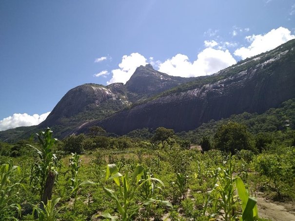
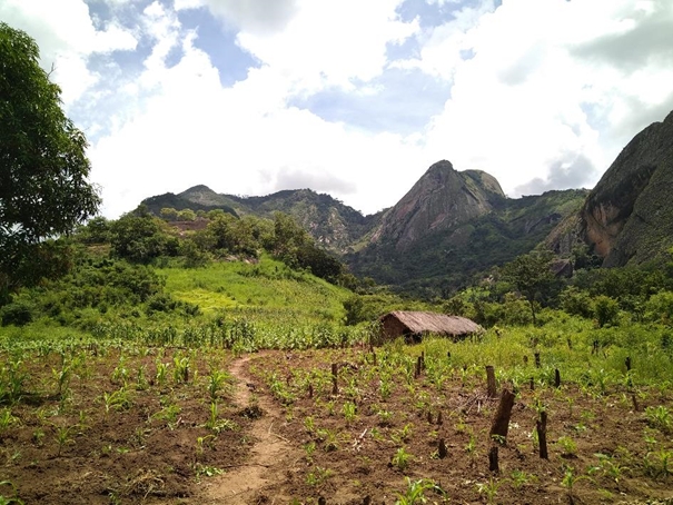
After the Mount Namuli, Nitidæ and Legado started their first activities in Ribaue, Nampula province
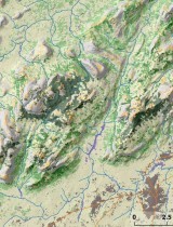
The Ribaue Mountains (composed of Mount Ribaue and Mount M'paluwe) are part of the inselberg belt, considered as a center of endemism, extending from northeast to southwest across Nampula and Zambezia province and including Mt Namuli. The expansion of subsistence agriculture on the slopes of the Ribaue Massif is a serious threat to forests and forest habitats. First field missions carried out in 2019 and February 2020 provided data to feed the analysis of landscapes and conservation issues, as well as an agrarian diagnosis that will be carried out.
A first land use and land cover map of the Ribaue Mountains and its surroundings, using Sentinel-2 images, was produced by the Nitidæ team (the report is available below). This analysis allows to update extent of remaining forest patches of moist evergreen forest on the Mount Ribaue and Mount M’paluwe, estimated in 2019 at 1185 ha and 473 ha, respectively. These data will be updated regularly to monitor changes in forest cover on the Ribaue Mountains.