N'Lab
N'Lab
The Research and Development department of the association has the mission to monitor, analyse and model the dynamics of landscapes and territories in order to improve the management of development projects and evaluate the socio-environmental impacts ex-ante or ex-post. It contributes to design the projects of the association in order to account for the last research results for the direction of activities and to anticipate the monitoring of impacts as of the beginning of the project. This laboratory brings together the technical and scientific expertise of Nitidæ (remote sensing, spatial modelling, geographic information system, soil science, forest ecology, biodiversity, hydrology, etc.) and works in close collaboration with scientific research (research institute international universities and universities).
The vision and originality of N'Lab is to conduct research programs within the NGO projects in order to address local territorial issues and to ensure the operationalization of its research (see list below). To this end, the international team use state-of-the art Earth observation technologies (optical and radar satellites, drones, machine learning algorithms, big data, etc.) and seeks to ensure the transfer and reproducibility of the tools developed (open source software, genericity and robustness of the methods). Training is used as an engine for the development of local expertise (PhD students, transfer of skills, etc.) and through the structuring of "Lab" in the different countries of intervention.
The dedicated N'Lab website can be consulted on this link: https://www.lab.nitidae.org/
The approach
The research program
Expertise
Scientific publications
Partners
The approach
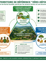
Three strategic axes structure the research activities of the N'Lab in order to link tools and methods development with the needs of the stakeholders involved in landscape and territory management.
Observation of the landscapes and territories
The objective is to monitor and analyse past and current social and economic environmental dynamics in order to provide objective and spatialized information for the territory's stakeholders. The applications of this line of work are the implementation of Land Monitoring System and multi-scale GIS (national, regional, project), required to manage and disseminate spatial information.
Rapid assessment of ecosystem services
The objective is to develop a method of analysis, using available spatial data and field knowledge, in order to quickly assess the state of natural resources and associated services. The method should allow to direct the actions in the field from the conception or the beginning of the implementation, in order to guarantee a positive impact in terms of ecosystems resilience.
Simulation and impacts of land use changes
The objective is to develop innovative approaches to project spatially and future potential land use change under different scenarios in order to assess their social and environmental impacts. The main application of this line of work is the implementation of a decision support tool in order to accompany the land use planning process.
The research program
N'Lab is currently implementing 5 research programs in one or more intervention countries of the association. These programs are carried out by the researchers of the association and by PhD students in each country of intervention.
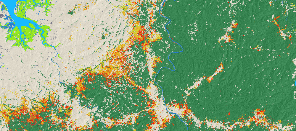
Monitoring and Simulation of Deforestation
The objective of this program is to develop a monitoring system and early-warning system of deforestation, in the short and medium term. The aim is to propose a monitoring tool to study and understand current and future dynamics in the defined area and to intervene in the most sensitive areas. This program uses state-of-the-art data and remote sensing tools and is mainly conducted in Madagascar.
Associated projects >> Talaky, BioSceneMada, Laurel, Bluemang, Mikéa
Territorial Planning for Improving Landscape Resilience
The objective of this program is to develop a prototype spatialized simulation tool for future land-use changes, originally developed for Mozambique but reproducible in other country. This tool aims to assess the potential environmental impacts of different scenarios (road infrastructure development, agricultural intensification, climate change, etc.) in order to help the Government or local authorities to establish their national territorial development plan.
Associated projects >> Laurel, PRM
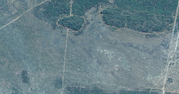
Monitoring of Agro-Forestry Systems
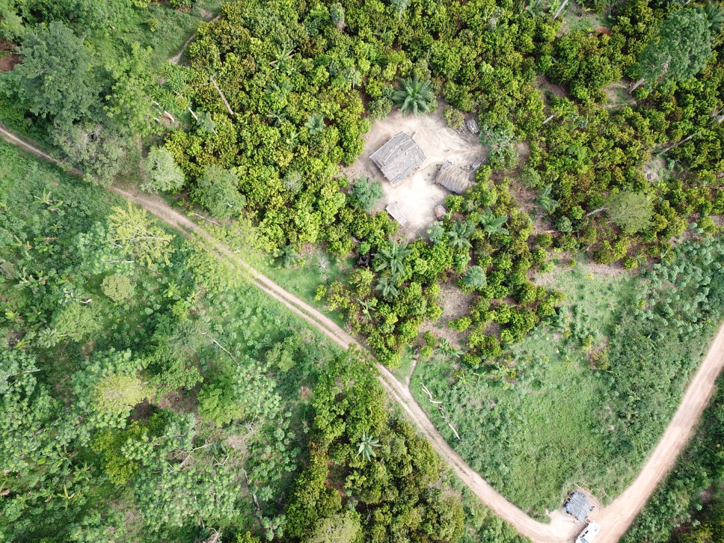
This program aims at developing innovative methods for multi-scale and multi-temporal monitoring of agroforestry systems in and around natural forests. The purpose of this program is to understand the factors that influence the changes, and thus contribute to the fight against illegal clearings and to improve the management of agroforestry systems. This program is currently being developed mainly in Côte d'Ivoire.
Associated project >> PRM
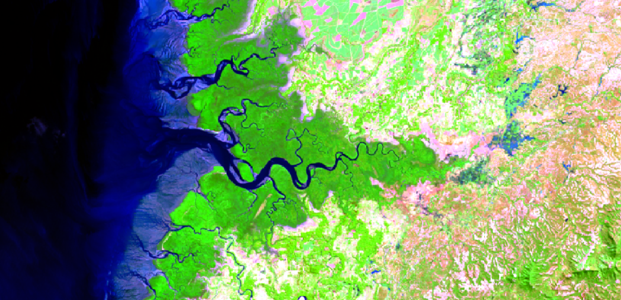
Modeling Impacts on Water Resources
The objective of this program is to evaluate the impacts on the water resource (quantity and quality) of changes in land use and water withdrawals for agriculture and the drinkable water supply of catchments, small (e.g. around tens of hectares) and medium size (e.g. over several county). The purpose is to anticipate the impacts of developments already achieved and reduce conflicts of use current or future. Monitoring systems for water resources and models are currently being carried out in Madagascar.
Associated projects >> Kolorano, Mahavotra 2
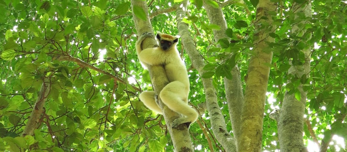
Characterization and spatial distribution of biodiversity
The objective of this program is to test different methods of characterization and monitoring of the spatial distribution of biodiversity in tropical forest, wet or dry forests. These methods use and combine field and floristic inventories in the field with modelling approaches (species distribution model) and / or remote sensing (multi and hyperspectral data). The tests are carried out on all the countries of intervention of the association.
Expertise
The methods and tools developed as well as the different skills of the N'Lab experts allow intervening more punctually on the projects of the association and with partners. The themes and studies already carried out are presented below:
Forest and REDD+
Assessment of carbon stocks in above-ground biomass, rates of deforestation / forest degradation, greenhouse gas (GHG) emissions related to deforestation / degradation, climate benefits, communities and biodiversity of REDD+ projects, etc.
Land degradation and restoration
Mapping at different scales of past land degradation, assessment of dynamics, limitations and ecosystem regeneration capacities, etc.
Land Cover Dynamics
Mapping land use and dynamics (multi-temporal) based on satellite image processing, participatory mapping of land-use scenarios to develop land use plans at village or county scale.
Biodiversity analysis
Analysis of natural and anthropogenic factors influencing woody biodiversity, mapping of habitats, analysis of wildlife movements, monitoring of biodiversity in a protected area (diversity, abundance, etc.).
Water resource management (IWRM)
Assessment and simulation of water resources dynamics at watershed scale.
Scientific publications
2020
Montfort F., Bégué A., Leroux L., Blanc L., Gond V., Cambule A., Remane I., Grinand C., 2020. From land productivity trends to land degradation assessment in Mozambique: Effects of climate, human activities and stakeholder definitions. Land Degradation & Development 32, 49-50.
>> Read
Rakotovao H.N., Ramifehiarivo N., Grinand C., Razakamanarivo R.H., Abrecht A., Razafimbelo T., 2020. Effects of agroecological practices on soil organic carbon sequestration using synchronic and diachronic approaches in Madagascar. Journal of Agriculture and Rural Development in the Tropics and Subtropics, 121, 1, 113-125.
>> Read
Vieilledent G., Nourtier M., Grinand C., Pedrono M., Clausen A., Rabetrano T., Rakotoarijaona J.-R., Rakotoarivelo B., Rakotomalala F. A., Rakotomalala L., Razafimpahanana A., Ralison J.M., Achard F., 2020. It’s not just poverty: unregulated global market and bad governance explain unceasing deforestation in Western Madagascar. pre-print bioRxiv.
>> Read
Grinand C., Vieilledent G., Razafimbelo T., Rakotoarijaona J.R., Nourtier M., Bernoux M., 2020. Landscape‐scale spatial modelling of deforestation, land degradation, and regeneration using machine learning tools. Land Degradation & Development 31, 1699 - 1712.
>> Read
2019
Montfort F., Bégué A., Leroux L., Grinand C., 2019. Sensitivity analysis of land productivity change calculation in Mozambique IGARSS 2019 - IEEE International Geoscience and Remote Sensing Symposium, Yokohama, Japan, 1633-1636.
>> Read
2018
Vieilledent G., C. Grinand, F. A. Rakotomalala, R. Ranaivosoa, J.-R. Rakotoarijaona, T. F. Allnutt, and F. Achard, 2018. Combining global tree cover loss data with historical national forest-cover maps to look at six decades of deforestation and forest fragmentation in Madagascar. Biological Conservation. 222: 189-197.
>> Read
2017
Grinand C., Le Maire G., Vieilledent G., Razakamanarivo H., Razafimbelo T., Bernoux M., 2017. Estimating temporal changes in soil carbon stocks at ecoregional scale in Madagascar using remote-sensing. Int. Journal of Applied Earth Observation and Geoinformation, 54, 1–14.
>> Read
Ramifehiarivo N., Brossard M., Grinand C., Andriamananjara A., Razafimbelo T., Rasolohery A., Razafimahatratra H., Seyler F., Ranaivoson N., Rabenarivo M., Albrecht A., Razafindrabe F., Razakamanarivo H., 2017. Mapping soil organic carbon on a national scale: Towards an improved and updated map of Madagascar. Geoderma, 12, 2.
>> Read
2016
Clairotte M., Grinand C., Kouakoua E., Thebault A., Saby N., Bernoux M., Barthès B., 2016. National calibration of soil organic carbon concentration using diffuse infrared reflectance spectroscopy. 276, 41-52.
>> Read
Grinand C., 2016. Suivi et modélisation des changements d’usage des terres et stocks de carbone dans les sols et les arbres dans le cadre de la REDD+ à Madagascar – Thèse de doctorat. Université de Montpellier - Montpellier SupAgro – AgroParisTech - Écologie Fonctionnelle et Sciences Agronomiques.
>> Read
Vieilledent G., Burren C., Gardi O., Grinand C., Andriamanjato M., Gardner C.J., Glass L., Camara C., Rasolohery A., Ratsimba H.R., Gond V., Rakotoarijaona J.R., 2016. Bioclimatic envelope models predict a decrease in tropical forest carbon stocks with climate change in Madagascar. Journal of Ecology.
>> Read
Rakotovao N.H., Razafimbelo T.M., Rakotosamimanana S., Randrianasolo Z., Randriamalala J.R., Albrecht A., 2016. Carbon footprint of smallholder farms in Central Madagascar: The integration of agroecological practices. Journal of cleaner production.
>> Read
2015
Rakotomala F.A., Rabenandrasana J. C., Andriambahiny J. E., Rajaonson R., Andriamalala F. , Burren C., Rakotoarijaona J.R., Parany B.L.E., Vaudry R. , Rakotoniaina S., Ranaivosoa R., Rahagalala P., Randrianary T., Grinand C., 2015. Estimation de la déforestation des forêts humides à Madagascar utilisant la classification multidates des images Landsat entre 2005, 2010 et 2013. Revue Française de Photogrammétrie et de Télédétection.
>> Read
2013
Grinand C., Rakotomalala F., Gond V., Vaudry R., Bernoux M., Vieilledent G., 2013. Estimating deforestation in tropical humid and dry forests in Madagascar from 2000 to 2010 using multi-date Landsat. Remote Sensing of Environment.
>> Read
Vieilledent G., Grinand C., Vaudry R., 2013. Forecasting deforestation and carbon emissions in tropical developing countries facing demographic expansion: a case study in Madagascar. Ecology and Evolution.
>> Read
2012
Grinand C., Barthès B.G., Brunet D., Kouakoua E., Arrouays D., Jolivet C., Caria G., Bernoux M., 2012. Prediction of soil organic and inorganic carbone contents at national scale using mid infrared reflectance spectroscopy (MIRS). European Journal of Soil Science, 2012, 63 (2), p. 141-151.
>> Read
Asner G.P., Clark J.K., Mascaro J., Vaudry R., Chadwick K.D., Vieilledent G., Rasamoelina M., Balaji A., Kennedy-Bowdoin T., Maatoug L., Colgan M.S. and Knapp D.K., 2012. Human and environmental controls over aboveground carbon storage in Madagascar. Carbon Balance Management.
>> Read
Vieilledent G., Vaudry R., Andriamanohisoa S.F.D., Rakotonarivo O.S., Randrianasolo H., Razafindrabe H.N., Rakotoarivony C.B., Ebeling J., Rasamoelina M., 2012. A universal approach to estimate biomass and carbon stock in tropical forests using generic allometric models. Ecological applications.
>> Read
2011
Asner G.P., Mascaro J., Muller-Landau H.C., Vieilldent G., Vaudry R., Rasamoelina M., Hall J.S., van Breugel M., 2011. A universal airborne LiDAR approach for tropical forest carbon mapping. Oecologia.
>> Read
Razakamanarivo R.H., Grinand C., Razafindrakoto, M.A., Bernoux, M., Albrecht, A., 2011. Mapping organic carbon stocks in eucalyptus plantations of the central highlands of Madagascar: A multiple regression approach. Geoderma, Volume 162, 3-4, 335-346.
>> Read
Le Maire G., Marsden C., Nouvellon Y., Grinand C. Hakamada J.S., Laclau J-P., 2011. MODIS NDVI time-series allow the monitoring of Eucalyptus plantation biomass. Remote Sensing of Environment, Volume 115, Issue 10, 2624-2625.
>> Read
2009
Grinand C., Rajaonarivo A., Bernoux M., Pajot V., Brossard M., Razafimbelo T.M., Albrecht A., Le Marthret H., 2009. Estimation des stocks de carbone dans les sols de Madagascar. Etude et Gestion des Sols 16, 23-33.
>> Read
Grinand C., Arrouays D., Laroche B., Martin M.P., 2008. Extrapolating regional soil landscapes from an existing soil map: Sampling intensity, validation procedures, and integration of spatial context. Geoderma, 143, 180-190.
>> Read
Partners
N'Lab actions
BISBI - Implementation of a nationwide spatial tool to monitor the evolution of invasive species and their collection as part of the installation of…
See moreN'Lab documents
Rapport Annuel 2025
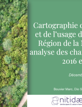
Presentation - Land use mapping of the Mé region for 2025 and change analysis between 2016 and 2025 (french)