Land occupation and use in the Mé Region, Côte d'Ivoire: deforestation continues, but conservation efforts are beginning to bear fruit
A study carried out as part of the PRM2 Project (Preserve the biodiversity of Mabi-Yaya & Strengthen the socio-economic development of the Mé) by the Nitidæ team is now published. The study aims to analyze both the current state of land occupation and use in 2022 and their recent changes over the past 6 years in the Mé region.
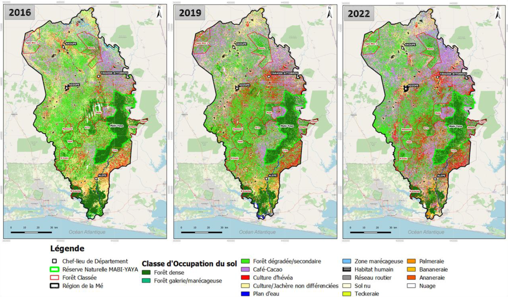
Dynamics of land occupation and use in the Mé region in 2016, 2019 and 2022
Results
The results of the mapping of land occupation and use in the Mé region in 2022 reveal that forest formations (dense forests, gallery forests and secondary forests) have regressed from 2016 to 2022, from 407,308 ha in 2016 to 362,697 ha in 2019 then to 335,837 ha in 2022. The annual deforestation rates are 3.87% over the first period (2016-2019) and 2.56% over the second period (2019- 2022). Despite continuing deforestation, the annual rate has nevertheless been reduced by more than 30%, testifying to the many efforts made in the Mé region to preserve forest ecosystems. This is explained in particular by the creation at the end of 2019 of the Mabi-Yaya Nature Reserve where the annual rate of deforestation has been greatly reduced, from 1.55% (2016-2019) to 0.59% (2019-2022). ), i.e. more than 60% slowdown in deforestation.
The main direct factors of deforestation and forest degradation in the Mé region over the periods 2016-2019 and 2019-2022 are the perennial crops of cocoa-coffee and rubber. Indeed, these cultures are the most practiced in the region whose areas are around 225,000 ha for cocoa-coffee and 78,000 ha for rubber in 2022. These two cultures are at the origin of the disappearance of more than 20 % of degraded or secondary forests over the period 2019 to 2022. And cocoa-coffee cultivation remains the main cause of deforestation in the Mabi-Yaya Nature Reserve between 2016 and 2022.
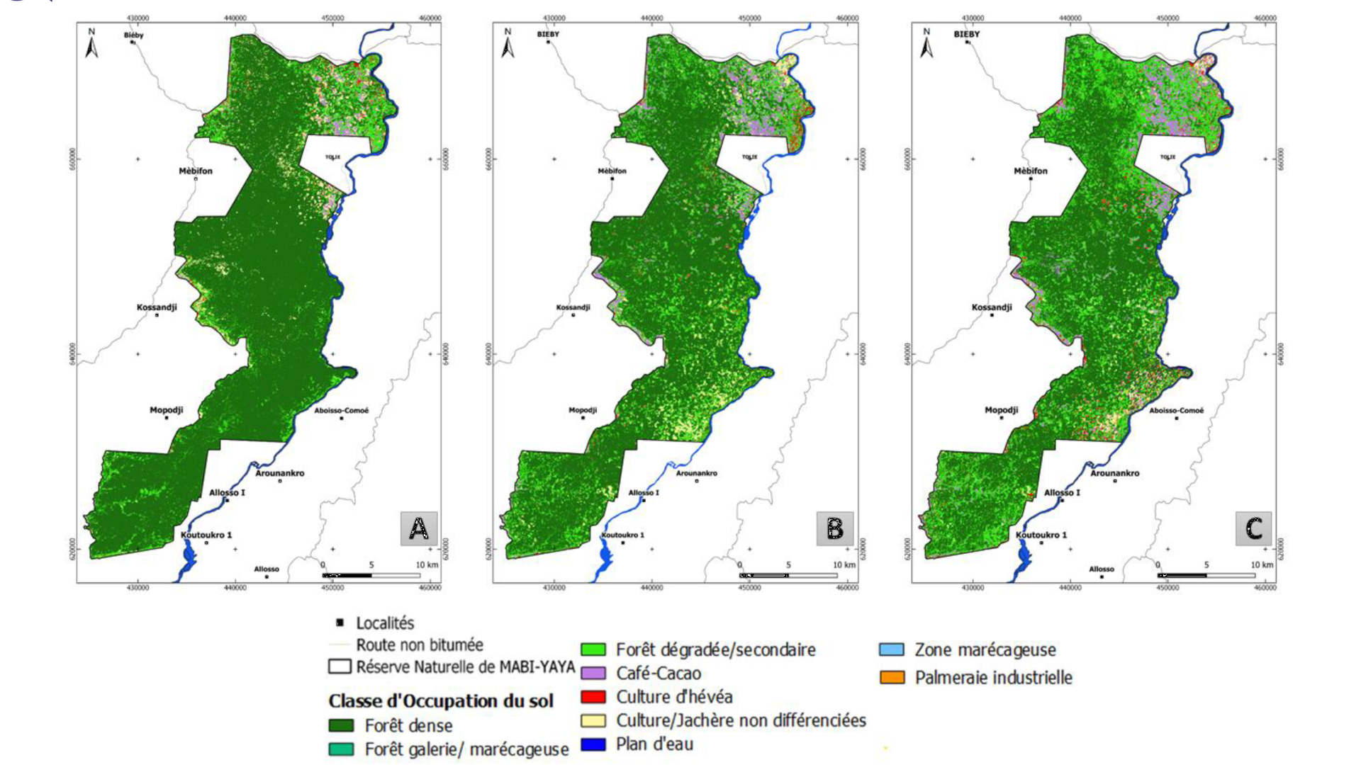
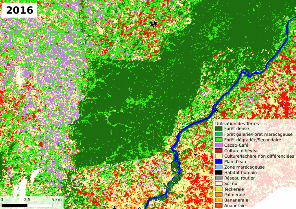
Land cover map of the Mabi-Yaya Nature Reserve in: A/ 2016, B/ 2019 and C/ 2022. To consult the map in High Definition, please use the online viewer
Action of Nitidæ
Working in the Mé Region since 2016 (Projects PRM then PRM2), particularly on the outskirts of the Mabi-Yaya Nature Reserve, Nitidæ is delighted with this significant slowdown in deforestation, despite the significant anthropogenic pressures that persist. To minimize these pressures, Nitidæ continues to intervene in the areas of cocoa and rubber to stop the pioneer front, in forestry, and in the areas of bananas and cassava to ensure food security for the populations. Since 2016, fifteen peripheral villages have been supported to draft their local development plan and to finance basic social infrastructure. To ensure the preservation of the Mabi-Yaya Nature Reserve and the local development of the neighboring populations, Nitidæ works closely with its partners, the Ivorian Office of Parks and Reserves (OIPR), which manages the Reserve, and the Mé Regional Council, for the territory planning.
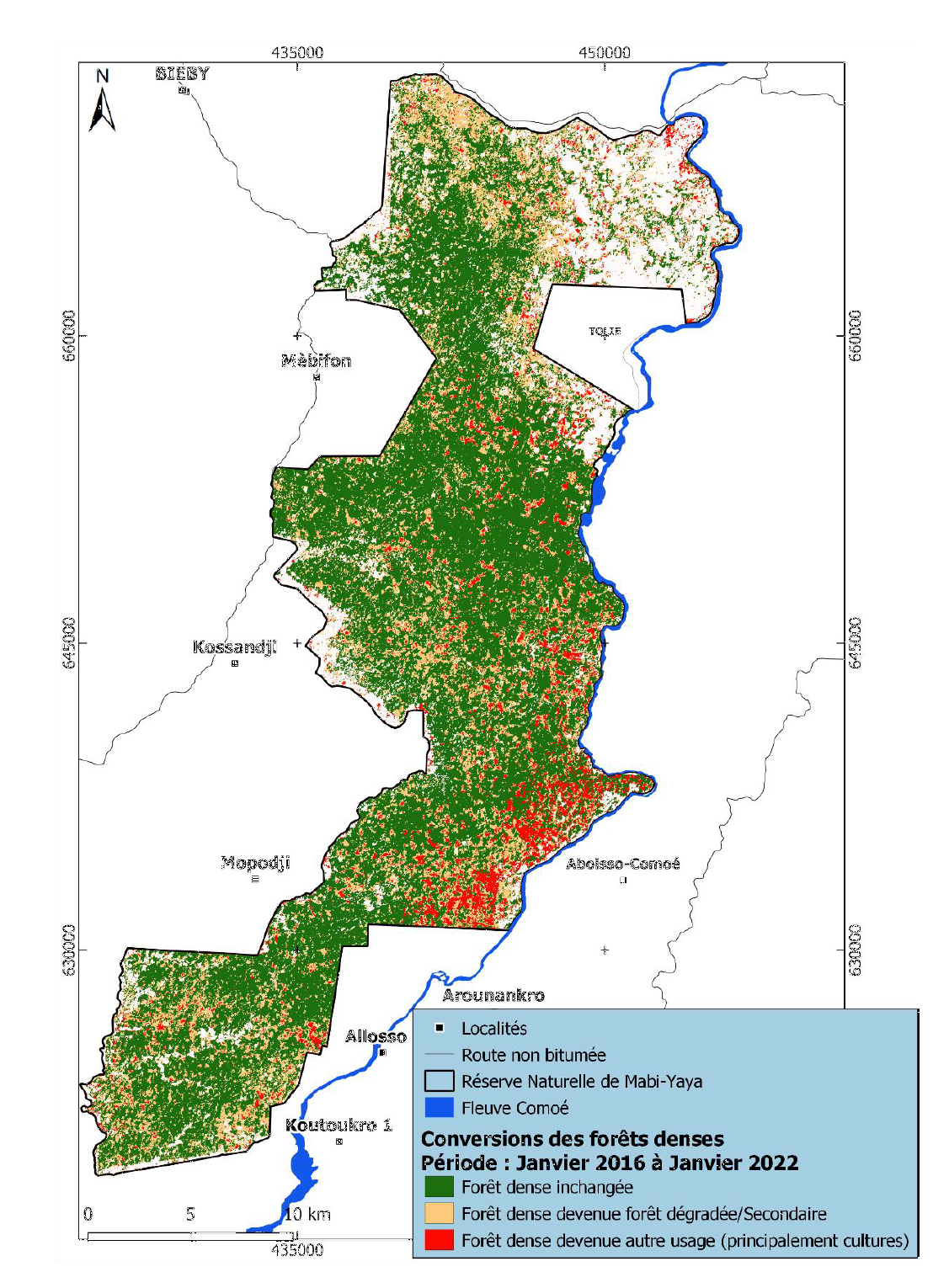
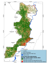
Evolution of dense forest formations in the Mabi-Yaya Nature Reserve over the period January 2016 to January 2022. To view the High Definition map, please use the online viewer or download data
Methodology
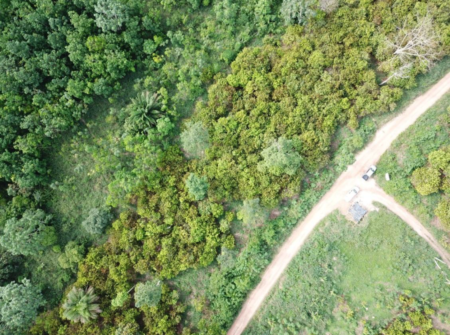
This study is based on mapping activities previously carried out for the years 2016 and 2019 as part of the Mé REDD+ project (PRM). These maps have been updated here with a new mapping of land cover in 2022. The method uses the same tools as those used previously, in particular the use of the National Land Classification System and the use of an powerful algorithm machine learning. However, it brings some methodological innovations through the use of Planet images, in particular to fill the lack of exploitable Sentinel 2 data and using the same reference month for the 3 pivotal years (January). As for previous studies, calibration and validation of the mapping was carried out through field campaigns, acquisition of drone images and observation of independent very high resolution satellite images processed images. With three dates analyzed, this study makes it possible to approach in a very precise way the spatio-temporal dynamics between 3 periods, 2016-2019, 2019-2022 and 2016-2022, highlighting phenomena of acceleration and slowing down of certain changes. The methodology developed in this study, through its potential for large-scale deployment and at lower cost, will be promoted through the activities of the "Green Cell" of the Regional Council of the Mé and could be of great interest to the structures in charge of the development of a Spatial Land Monitoring (SST) system and supporting sustainable development policies.
Animated image of the land cover of the southern part of the Mabi-Yaya Nature Reserve in: A/ 2016, B/ 2019 and C/ 2022
Quote
Ouattara T.A., Grinand C., Garnier B., Lapeyre R., Vergnes V. (2023). État des terres de la région de la Mé entre 2016 et 2022. Nitidæ, 40p. https://doi.org/10.5281/zenodo.7903157
Access to data
Download: https://doi.org/10.5281/zenodo.7903157
Online consultation: http://vps-52ff0907.vps.ovh.net:8090/index.php/view/map/?repository=prm&project=Etats_des_Terres_en_2022