What is the impact of cash crops on the forests of south-eastern Côte d'Ivoire (former cocoa loop)?
A study carried out as part of the project REDD+ de la Mé (PRM) by the Nitidæ team and their partner of the Permanent Secretariat of REDD+ (SEP-REDD+), was recently published in the journal Bois et forêts des tropiques.
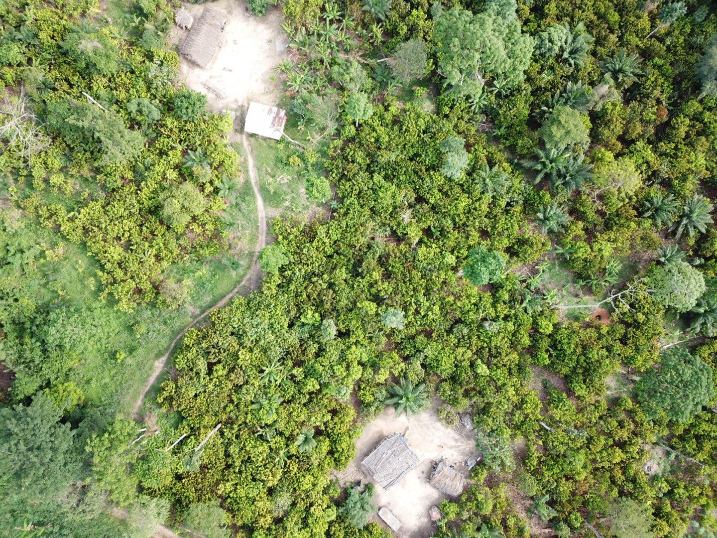
This study deals with an interannual and recent analysis of deforestation in Côte d'Ivoire through a spatial assessment of the causes and impacts of cash crops. It is part of a context of dynamic deforestation and significant forest degradation in the old cocoa loop (south-eastern Côte d'Ivoire).
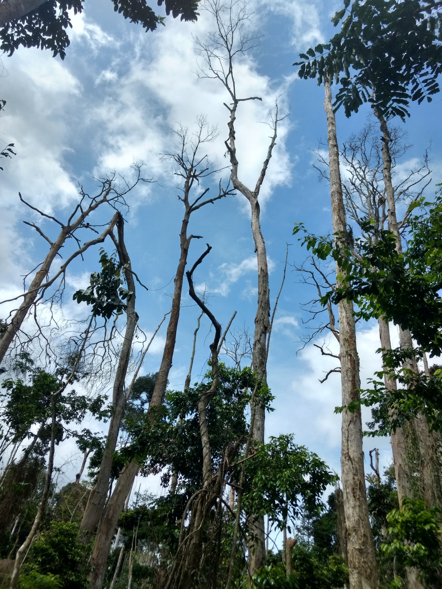
Trees devitalized following the installation of cocoa cultivation in the classified forest of Bossématié (view upwards showing the disappearance of the foliage).
This study is the result of several years of work initiated as part of the REDD+ project of the Mé (PRM) in 2016. It aimed to assess changes in land use and land use, in particular the dynamics of forest deforestation and degradation in three regions of south-eastern Côte d'Ivoire (Mé, Sud-Comoé and Indénié-Djuablin regions), between 2016 and 2019. The methodology developed is based on satellite images Sentinel-2, the Random Forests algorithm and a significant effort to collect training data in 16 categories of land cover and use. The purpose of this work is to provide new knowledge in order to contribute to the sustainable management of land and the fight against illegal clearing in classified forests and protected areas in Côte d'Ivoire.
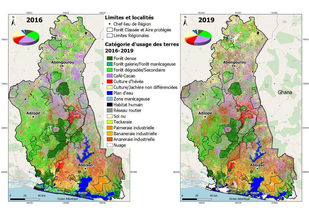
Land occupation and use maps and distribution diagrams of types of land use in 2016 and 2019 in the south-east of Côte d'Ivoire (Mé, Sud-Comoé and L'Indénié-Djuablin)
The study shows that the extension of cash crops (cocoa-coffee, rubber and oil palm), undifferentiated crops and fallows as well as infrastructure (houses and roads), has led to a deforestation of 4.95% per year over the period studied. This study sheds new light and quantifies post-clearing land uses, in particular the impact of cash crops. It also underlines the importance of secondary formations in the landscape (old abandoned cocoa trees) and their recent conversions to other crops, particularly rubber.

Analysis of forest conversions between 2016 and 2019 concerning: A. dense forest formations; B. degraded or secondary forests
Ongoing reflections on technical choices, within the framework of spatial land monitoring (SST), could benefit from the lessons learned from this study. First, the results of this work show that it is possible, with satisfactory levels of uncertainty, to ** detect deforestation in degraded and secondary forests ** in addition to dense forests. This would significantly refine the Forest Reference Emission Level (FREL) transmitted by Côte d'Ivoire to the United Nations Framework Convention on Climate Change (UNFCCC).
The summary of the study is presented below and the article is available at the bottom of the page.