MAHAVOTRA 2 - Forestry, agroforestry and land use planning in Madagascar - Itasy region
Partners
Main goals
The overall objective is to contribute to the agricultural development of the Itasy Region and to improve territorial planning and management in the Itasy Region.
More specifically, it aims at an evolution of agriculture through a global restoration of the agroecological environment through a local network of service providers and the valorization of developed territory. It also aims to enhance the added value of agricultural products through the creation of three incubators in agro-transformation. It integrates a strengthening of local authorities in their capacities of territorial planning and management, so that they can guide the actors of the regional development, in particular by relaying the scalling-up actions of the service provision reinforced by the project.
Specific objectives
The Mahavotra project (phase 2) has two specific objectives:
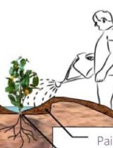
SO1. Improve agricultural production systems by developing sustainable local agricultural services and rehabilitating farmland
SO2. Strengthen local communities in their capacity to manage their territorial development and measure the effects and impact on the natural environment
Beneficiaries
Farmers of the Itasy Region, Communes, Itasy Region, Deconcentrated Technical Services of the State of Madagascar
Results
R1. A network of agricultural service providers, Master Farmers, is sustainable
R2. The added value of products from managed agricultural areas is increased by the development of local agro-processing services
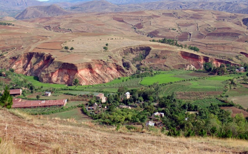
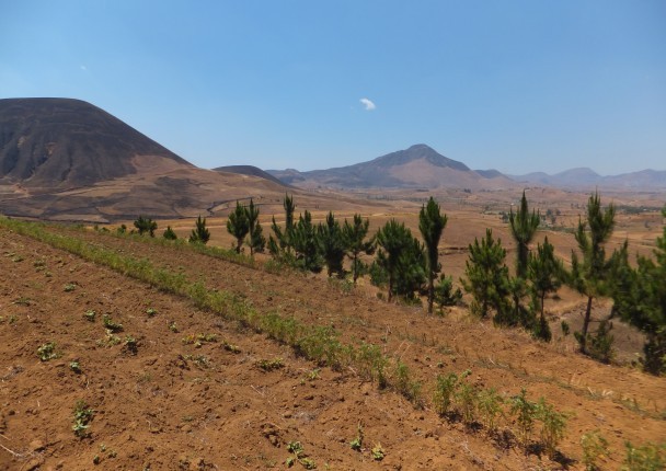
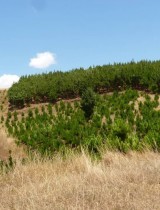
R3. Agricultural, agroforestry and forest areas are developed and managed
R4. The environmental and economic effects of the project are measured and quantified
R5. Regional planning and management capacities of the Region are strengthened
R6. Municipalities elaborate their Communal Development Plan (CDP)
Activities
A1. Supporting the Master-Operators in the development of their service activities and in the network structuring of the Master-Operators (1 structured network of 320 Master-Operators renders quality services to 2000 farms)
A2. Set up 1 business incubator in agro-processing and train and support agro-processing entrepreneurs
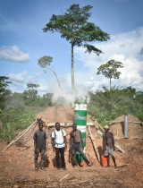
A3. Design plans for the management of forest areas, monitor plantations and train forest management (1500 ha of managed agricultural land during phase 1 and 2 project duration and micro-forest management guides are developed)
A4. Assess the environmental and socio-economic impact of adopting agroecological practices and develop medium-term scenarios (the carbon sequestration potential in soil and wood is assessed and a climate impact calculator and socio-economic allows to analyze different scenarios of planning and management of land)
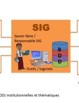
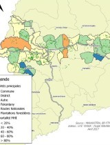
A5. Initiate and support the establishment of a Regional Geographical Information System (a GIS diagnostic, training cycles with stakeholders in the Region, a regional database and cartographic references are conceived and produced, the regional GIS cell Itasy is created and functional)
A6. Elaborate Municipal Planning Schemes for two municipalities in the Region
Related documents
Support for the establishment of a Regional GIS unit for the Mahavotra Forestry, Agroforestry and Land Management Project
History and achievements of the regional GIS in Itasy
Impact of agroecological practices on soil organic carbon sequestration using synchronic and diachronic approaches on ferralsols and andoso…
Outcome report of the component 4 - Environmental and economic effects of forest plantations
Forest plantation diagnosis of the Mahavotra project
Forest micro-stands management guide
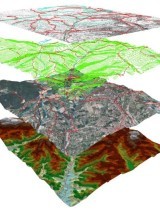
Diagnosis of resources and use of Geographic Information Systems (GIS) in the Itasy Region
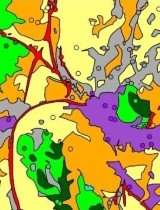
Report of identification of agro-ecological systems by remote sensing in Itasy Region
Measurement protocol - Pre-assessment of carbon sequestration planted species biomass
Related people
Clovis Grinand
PhD in Functional Ecology and Agronomic Sciences (SupAgro, IRD and CIRAD) and specialized in Localized Information Systems for Spatial Planning (AgroParisTech), he is an expert in land use change monitoring using remote sensing, digital soil mapping and spatial modeling applied to forestry, agronomy and landscape ecology. He is the author of numerous international scientific publications.
See more
Fety Abel Rakotomalala
Currently a PhD student, he holds a DEA of Physics, specialised in "geophysics, remote sensing and GIS" from the Faculty of Sciences of Antananarivo in Madagascar (IOGA). He brings his expertise to the impacts of deforestation, above-ground biomass mapping and scenario development of carbon emissions
See moreMAHAVOTRA - Pilot project to evaluate t…