PERR-FH - Eco-Regional REDD+ Project - Rainforests of Madagascar
Partners
Main goals
Like PHCF or Makira, various REDD+ projects (Reducing Emissions from Deforestation and Degradation of forests) have been implemented in Madagascar for the last ten years over large areas from north to south.
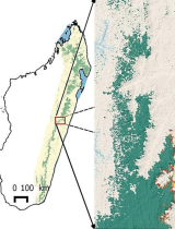
The variety of carbon accounting methods deployed so far by these projects has led the various REDD + stakeholders of the country to committ in an eco-regional approach that harmonise those methods and bring together all REDD+ initiatives around a developed vision, at the scale of 4.5 million hectares of rainforests.
After actively participating in the drafting of the R-PP, a readiness plan for REDD+ validated by the Forest Carbon Partnership Facility (FCPF) in July 2014, this project allows Nitidæ (ex-Etc Terra) to continue the ongoing commitment in Madagascar, both locally and nationally.
Specific objectives
- Facilitate the access of REDD + projects (current and future) to carbon markets
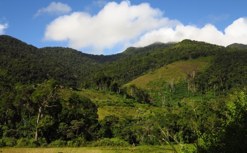
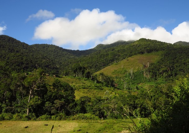
- Contribute in the country's preparation for REDD+ by initiating the eco-regional approach by Eastern Rainforests. The Madagascar forest ecosystem has the greatest potential in terms of REDD+
Results
R1. Keep Madagascar among the most innovative countries in REDD+ projects. Indeed, despite major political crisis that took place in the country from 2009 to 2014, Madagascar is still one of the most advanced African countries in the field of REDD+. This is particularly true as regards to these methodological questions that are crucial to the mechanism's credibility.
R2. Contribute to the valorization of emission reductions (or carbon credits) generated at the eco-regional level by the various actors in the field.
Beyond the economies of scale that will be carried out thanks to this project, the PERR-FH has already allowed Madagascar to apply as a beneficiary country of the FCPF Carbon Fund.
Activities
A1. Preparation of the reference emission level according to VCS and FCPF methodological frameworks
A2. Mapping of carbon stocks (biomass and soil) based on a large field inventory campaign
A3. Update of the historical analysis of deforestation over the period 2005-2010-2013
A4. Projection of future deforestation and CO2 emissions associated with it
A5. Definition of an environmental and socio-economic reference state
A6. Development of carbon monitoring systems, deforestation factors and environmental and socio-economic impacts
Related documents
Estimated deforestation of rainforests in Madagascar using multi-dated classification of Landsat images between 2005, 2010 and 2013
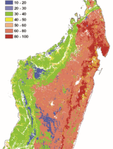
Estimation of carbon storage in Madagascar soils
Related people

Clovis Grinand
PhD in Functional Ecology and Agronomic Sciences (SupAgro, IRD and CIRAD) and specialized in Localized Information Systems for Spatial Planning (AgroParisTech), he is an expert in land use change monitoring using remote sensing, digital soil mapping and spatial modeling applied to forestry, agronomy and landscape ecology. He is the author of numerous international scientific publications.
See more
Fety Abel Rakotomalala
Currently a PhD student, he holds a DEA of Physics, specialised in "geophysics, remote sensing and GIS" from the Faculty of Sciences of Antananarivo in Madagascar (IOGA). He brings his expertise to the impacts of deforestation, above-ground biomass mapping and scenario development of carbon emissions
See morePHCF2 - Holistic Conservation Programme…