Documents
Filters
Remote sensing
142
results
Communication
Biodiversity, Forest, Modeling, REDD+, Remote sensing
Master's thesis presentation - The importance of deforestation and climate change in shaping lemurs’ distributions and identifying their ar…
Technical document
Agriculture, Agroecology, Biodiversity, Climate, Forest, Remote sensing
Diagnosis of agrarian dynamics on the Eastern slope of Mount Namuli & Analysis of agricultural practices into deforestation dynamics and d…
Technical document
Spatial Planning, Degradation-Restoration, Forest, Remote sensing
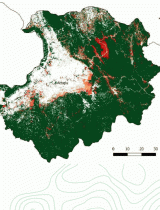
Land Use and Land Cover Map of Mount Namuli and surroundings
Project report
Agroforestry, Spatial Planning, Degradation-Restoration, Forest, Remote sensing
Outcome report of the component 4 - Environmental and economic effects of forest plantations
Project report
Agroecology, Spatial Planning, Degradation-Restoration, Forest, Remote sensing
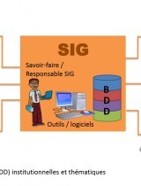
History and achievements of the regional GIS in Itasy
Technical document
Climate, Forest, Remote sensing
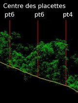
Using LiDAR for Aboveground Biomass Mapping in Madagascar - Pilot Study in the Moramanga Region
Pedagogical
Remote sensing, ICT
Drone (UAV) flight test and post-processing images - Potentials and reality
Project report
Organic Agriculture, Agroforestry, Spatial Planning, Bioenergy, Biodiversity, Forest, Market, REDD+, Remote sensing
Second Annual Activity Report of the Mé REDD+ Project
Pedagogical
Agroforestry, Spatial Planning, Degradation-Restoration, Forest, Remote sensing
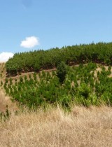
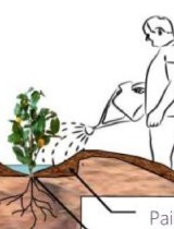
Forest micro-stands management guide
Technical document
Forest, REDD+, Remote sensing
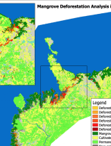
Deforestation map of mangroves in North-West Madagascar
Technical document
Forest, REDD+, Remote sensing
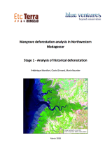
Mangrove deforestation analysis in Northwestern Madagascar
Annual reports
Agriculture, Organic Agriculture, Agroprocessing, Spatial Planning, Bioenergy, Biodiversity, Climate, Degradation-Restoration, Forest, IWRM, Market, Modeling, REDD+, Remote sensing, ICT
Nitidæ 2017 annual report
Project report
Agriculture, Spatial Planning, Forest, Modeling, Remote sensing
LAUREL Land Degradation Progress Report
Technical document
Agriculture, Climate, Forest, Remote sensing
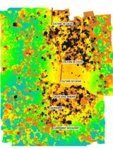
Rapid estimation and location of past deforestation - Use of Global Forest Watch data
Project report
Agriculture, Spatial Planning, Forest, Modeling, Remote sensing