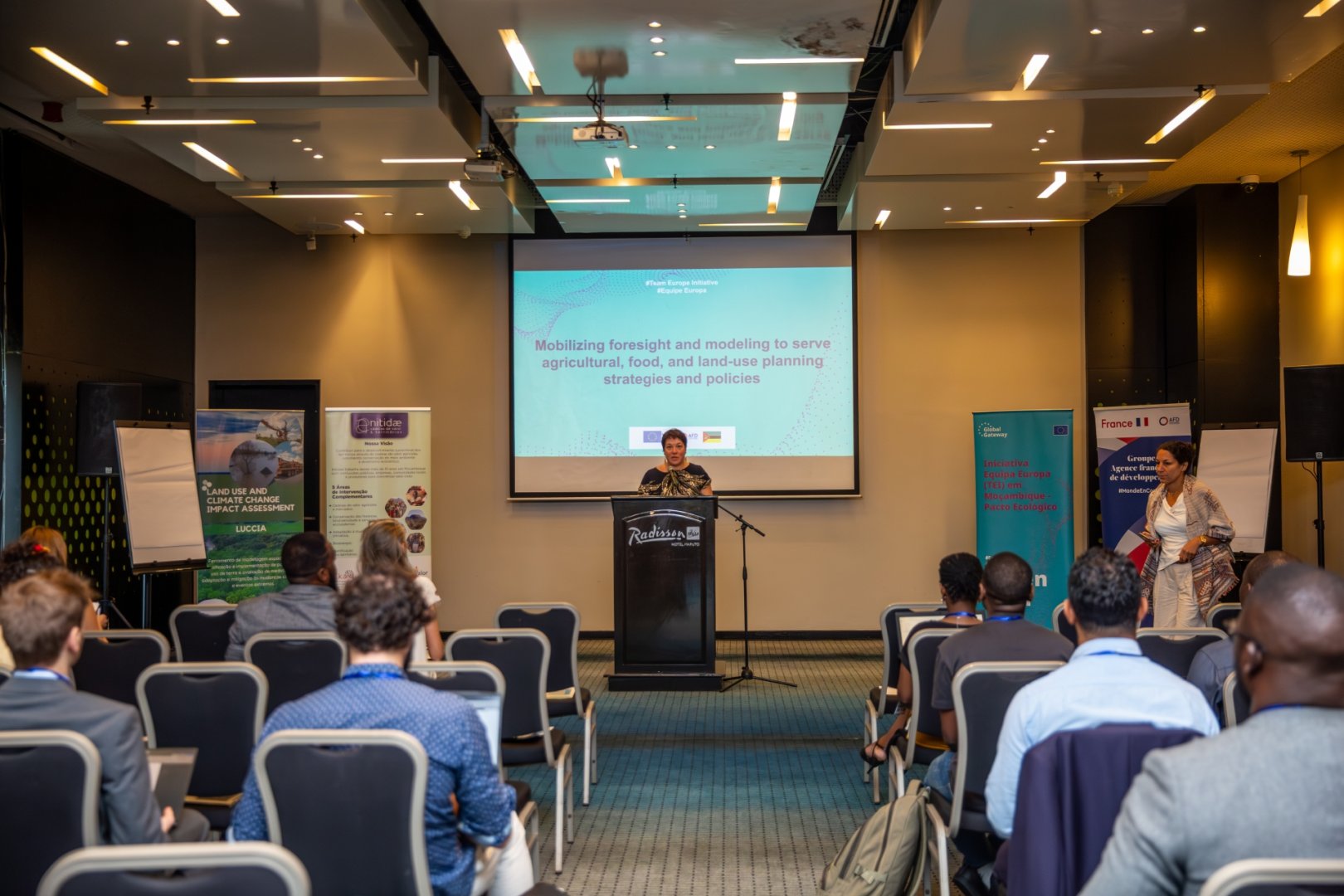
Presentation of the LUCCIA tool during a workshop on forecasting and spatial modelling
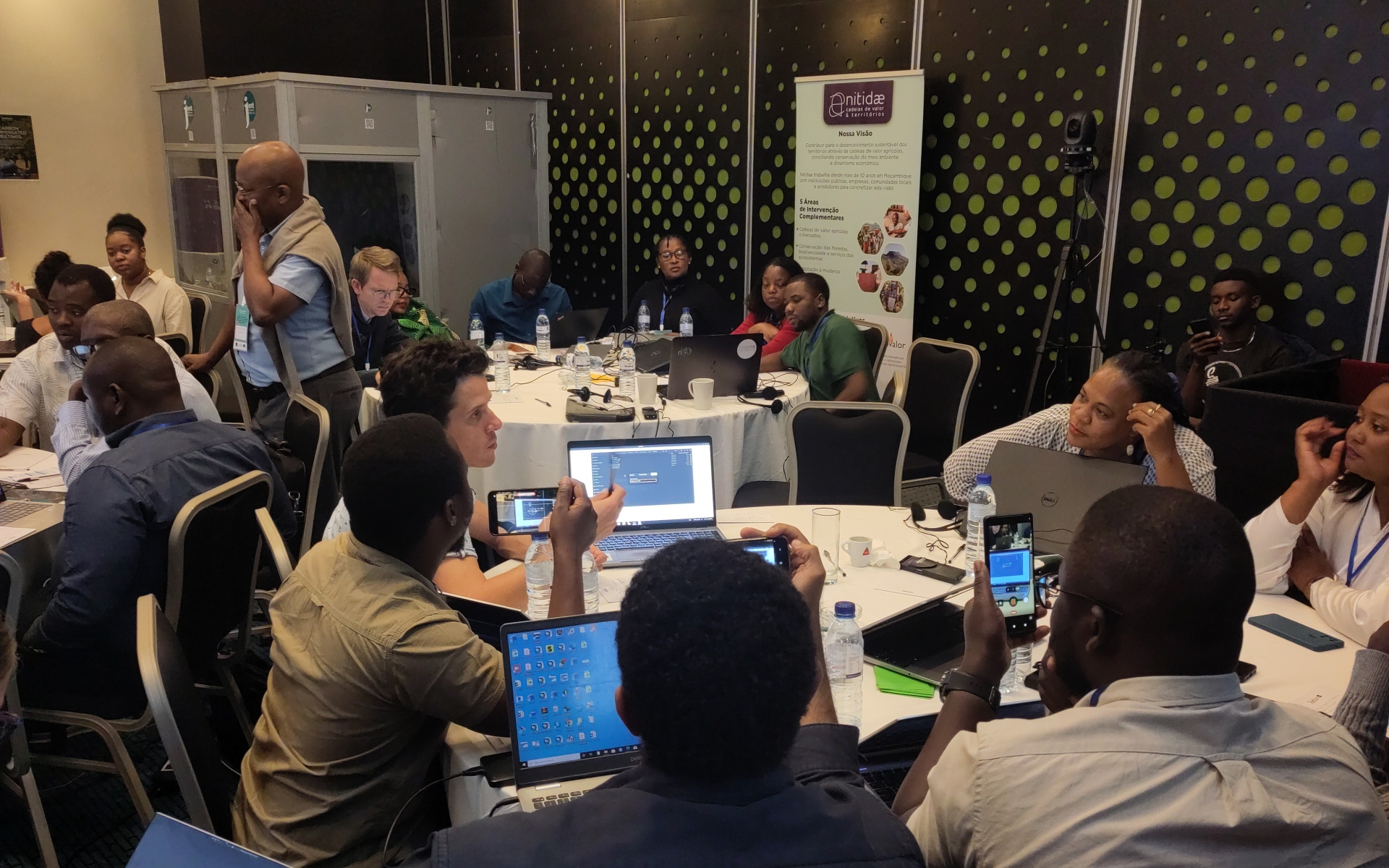
From 2nd to 5th December, Nitidæ took part in a workshop in Maputo on forecasting and modelling for agricultural, food and land use planning strategies and policies. The event was hosted by the Ministry of Agriculture, Environment and Fisheries (MAAP), the IIAM (Instituto de Investigação Agrária de Moçambique), the European Union, the Agence Française de Développement (AFD), and jointly organised by CIRAD and Nitidæ. It was part of the pilot phase of the MoSAFS project (Modelling Pathways for a Sustainable and Agroecological Transition of Food Systems in Africa) funded by the Joint Research Centre (JRC) and a capitalisation phase of the LUCCIA project (Land Use and Climate Change Impact Assessment) led by Nitidae. These two initiatives seek to co-construct future scenarios at national level for the sustainability of agricultural systems using appropriate modelling tools.
The main objective of this workshop was to mobilise, meet and discuss these issues with representatives and technicians from various ministries, technical and research institutes, as well as civil society actors. Discussions focused on a common understanding of foresight and modelling in the agricultural, food and land use sectors; their use in the development of public agricultural policies; and the availability and quality of data in Mozambique to feed into these tools and methods. One day was dedicated to presentations by Mozambican speakers, initiatives and institutions that are developing simulation models or data platforms, as well as representatives from the Angolan Ministry of Agriculture, leading to rich discussions and debates.
LUCCIA, a project and tool using landscape modelling for foresight and supporting decision-making in the agriculture and forestry sectors (AFOLU)
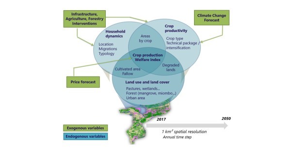
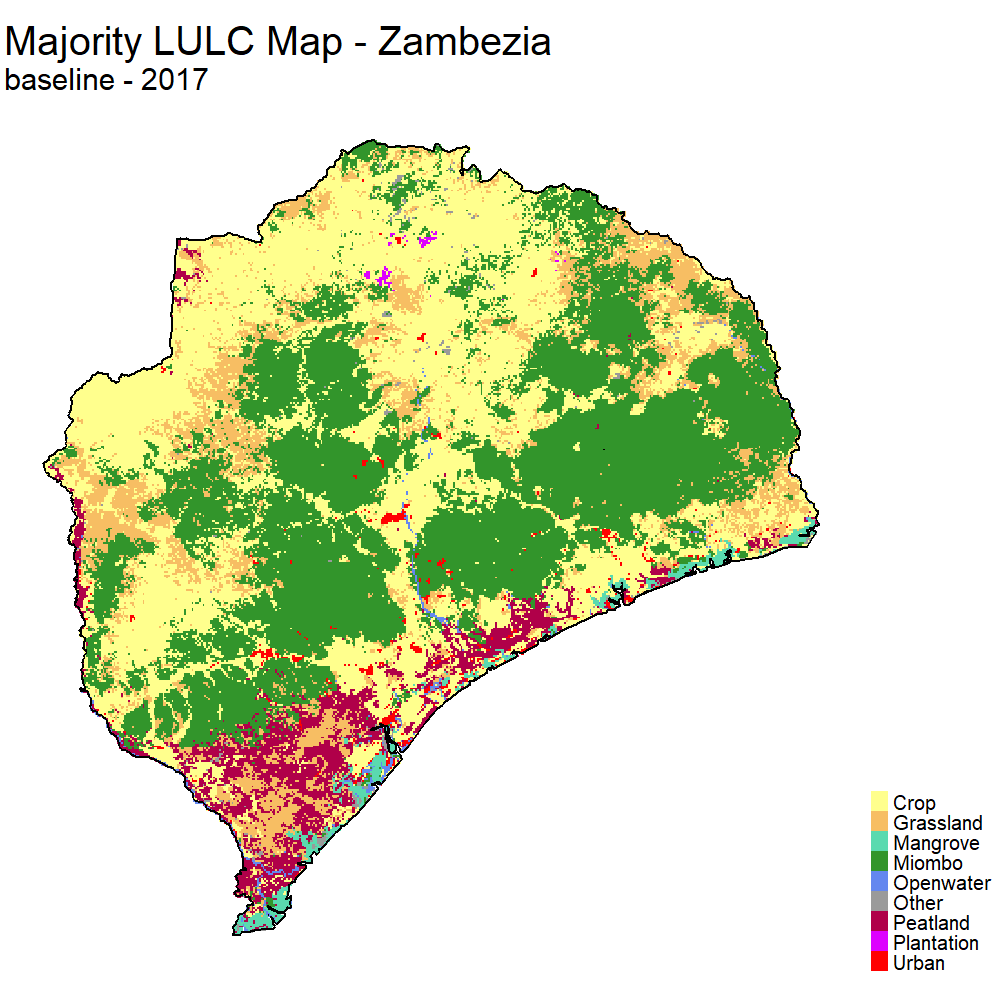
For the LUCCIA project team, this was an opportunity to present the important modelling work that was carried out during the development phase (2022-2023) and the last improvements (2025 with new version 1.1). Developed in partnership with the CIRAD's TETIS joint research unit, this tool enables the ex-ante impact assessment of land use planning policies or projects based on a model focused on the dynamics of rural households, spatially integrated by 1 km² landscape units across Mozambique. It generates numerous socio-economic, agricultural and environmental indicators annually from 2020 to 2050.
The model includes a wide variety of processes (e.g. demography, migration, deforestation, annual and multi-annual crops, urbanisation) developed with national experts and based on Nitidæ's field knowledge, relies on a large set of official national data (e.g. census, agricultural statistics, agricultural household survey, land use map, etc.) or data produced by the project teams (maps of current and future agricultural yields, soil suitability maps for more than a dozen annual and perennial crops). Most of the spatial data has recently been made available online and can be consulted via geoportals.
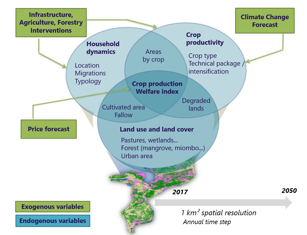
The output entails more than 200 primary indicators spatialised to a landscape unit of 1 km², whether socio-economic (urban and rural population, type of agricultural household, agricultural income), related to agriculture (cultivated area and production for the 10 main cash and food crops in Mozambique) or environmental (land use / land cover, deforestation, GHG emissions). Some variables combined together make it possible to compute secondary indicators such as average household income or food security. All indicators are aggregated at the jurisdictional level (district, province) to facilitate dialogue with decision-makers.
During the LUCCIA project, the objective was to produce a tool capable of evaluating national strategies for low-carbon development (e.g. REDD+, NDC) and land use planning at national or local level (e.g. district). A number of actions or interventions could be integrated, such as agroforestry, reforestation, industrial forest plantations, but also road construction and rehabilitation, the creation or improved management of protected areas, and agricultural intensification.
LUCCIA technical training and familiarisation day
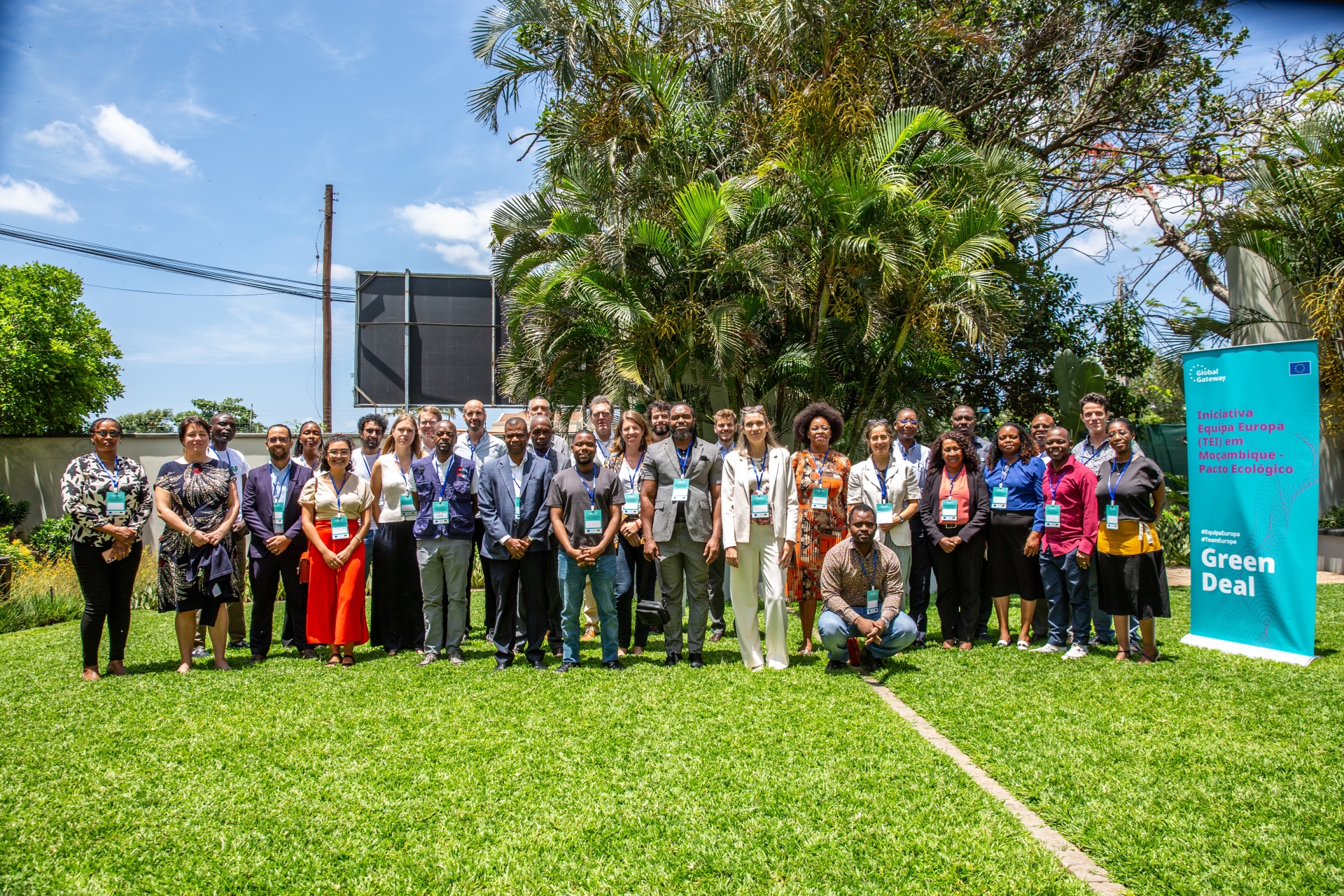
On 4th December, a full day of training on the use of the LUCCIA tool was held through group work. Participants were first asked to reflect, discuss and establish a future scenario for Mozambique or for a more specific area, incorporating a few specific interventions or trajectories, while considering the limitations of the model. They then configured and ran the simulation for this scenario. The last part of the day was dedicated to exploring and analysing the results and to a presentation of the scenarios and results obtained by each working group.
This opportunity allowed us to broaden the dissemination of the tool to many people who expressed interest in it!
Resources
You can find all the information and resources related to the LUCCIA tool at io.luccia-moz.com.
The site includes the listing of all the geoportals, a dashboard for exploring some of the results of the baseline scenario, and, most importantly, links to download the user manual and the tool (software and input data).
The latter will be updated over the coming months to incorporate the latest adjustments made with the release of version 1.2!
Related projects