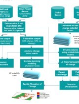
The article presents a method of spatializing deforestation, land degradation at the scale of landscapes and machine learning tools. The innovative method uses several spatial datasets representing the land change dynamics of the last twenty years, a statistical and quantitative analysis of the factors influencing each of these dynamics and a projection future over the next twenty years (2034) according to 3 different scenarios, at the landscape scale and on a regional scale.
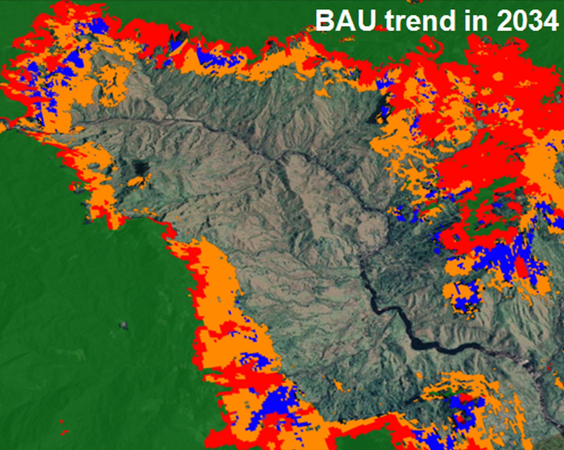
Business‐as‐usual scenarios highlighted the large areas under deforestation and degradation threat
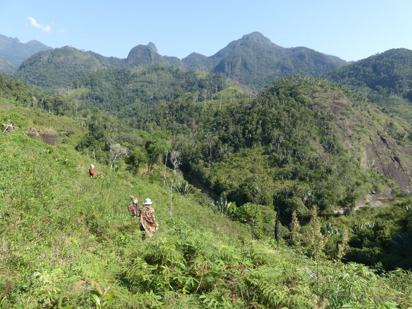
This pilot study was developed in the territory of the Talaky project. The purpose of this study is to contribute to improving the project interventions (understanding of the factors of change, priority areas of fight against deforestation and land degradation, priority areas for land restoration) and also contribute to the national strategy of fight against land degradation. Indeed, Madagascar is engaged for several years in the United Nations program to combat land degradation and recently launched an ambitious reforestation program.
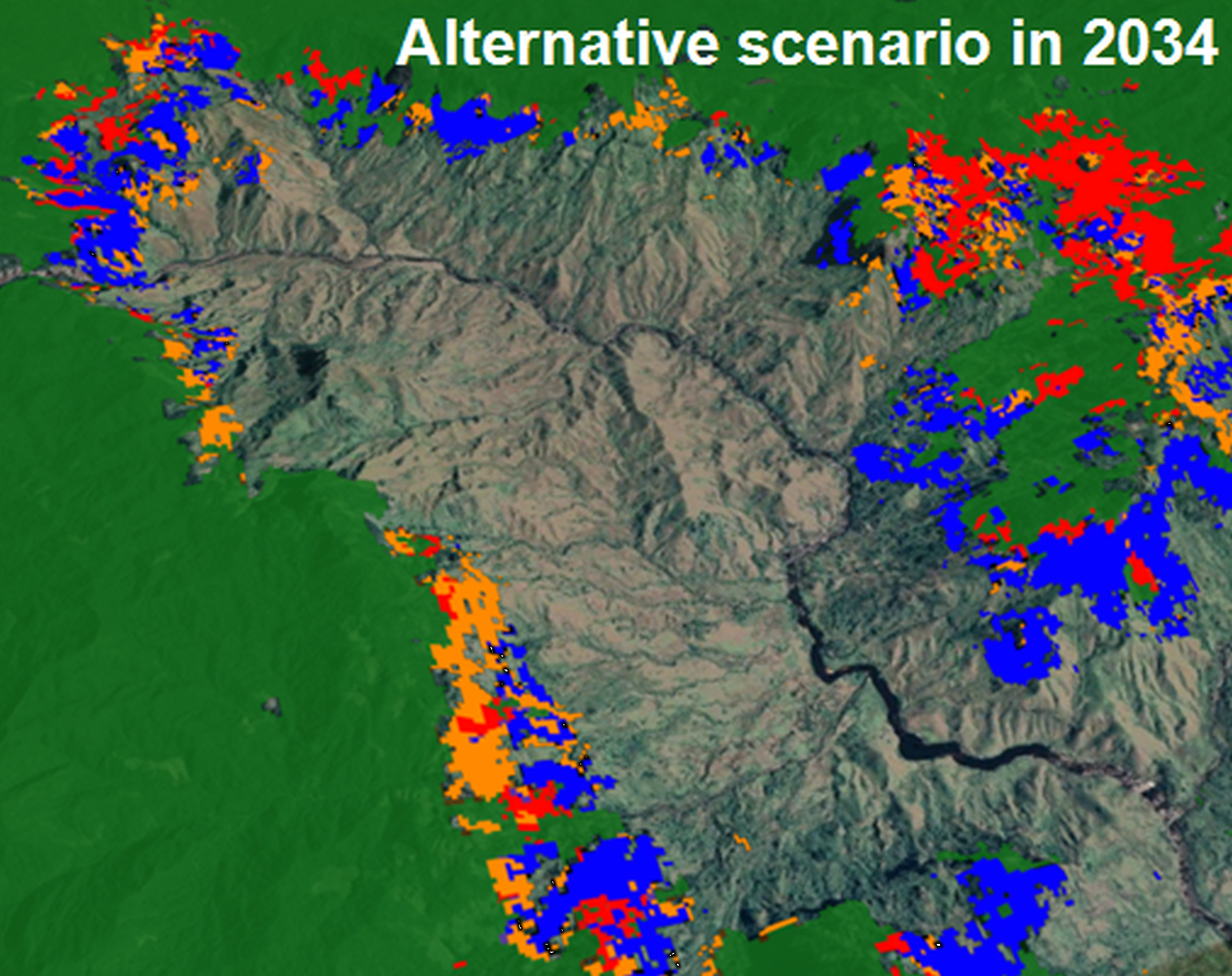
Alternative scenario enabled the location of suitable areas for regeneration
The summary of the study is presented below, the article is also available at the bottom of the page.
Land degradation and regeneration are complex processes that greatly impact climate regulation, ecosystem service provision, and population well‐being and require an urgent and appropriate response through land use planning and interventions. Spatially explicit land change models can greatly help decision makers, but traditional regression approaches fail to capture the nonlinearity and complex interactions of the underlying drivers. Our objective was to use a machine learning algorithm combined with high‐resolution data sets to provide simultaneous and spatial forecasts of deforestation, land degradation, and regeneration for the next two decades. A 17,000‐km2 region in the south of Madagascar was taken as the study area. First, an empirical analysis of drivers of change was conducted, and then, an ensemble model was calibrated to predict and map potential changes based on 12 potential explanatory variables. These potential change maps were used to draw three scenarios of land change while considering past trends in intensity of change and expert knowledge. Historical observations displayed clear patterns of land degradation and relatively low regeneration. Amongst the 12 potential explanatory variables, distance to forest edge and elevation were the most important for the three land transitions studied. Random forest showed slightly better prediction ability compared with maximum entropy and generalized linear model. Business‐as‐usual scenarios highlighted the large areas under deforestation and degradation threat, and an alternative scenario enabled the location of suitable areas for regeneration. The approach developed herein and the spatial outputs provided can help stakeholders target their interventions or develop large‐scale sustainable land management strategies.