Dynamics of landscapes in the protected areas of Pô-Nazinga-Sissili in Burkina-Faso: towards a new method of territorial diagnosis
The objective of this study is to propose a spatial analysis of territorial dynamics and their factors of change based on available spatialized socio-economic and environmental data, indicators from remote sensing and field knowledge. This analysis of pressures and factors of change aims to improve and/or reorient interventions in the territory. This also makes it possible to offer more widely an innovative and rapid method for the assessment of landscape dynamics.
Context
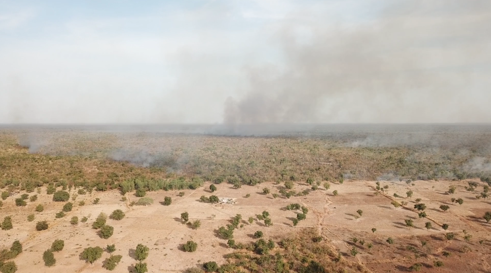
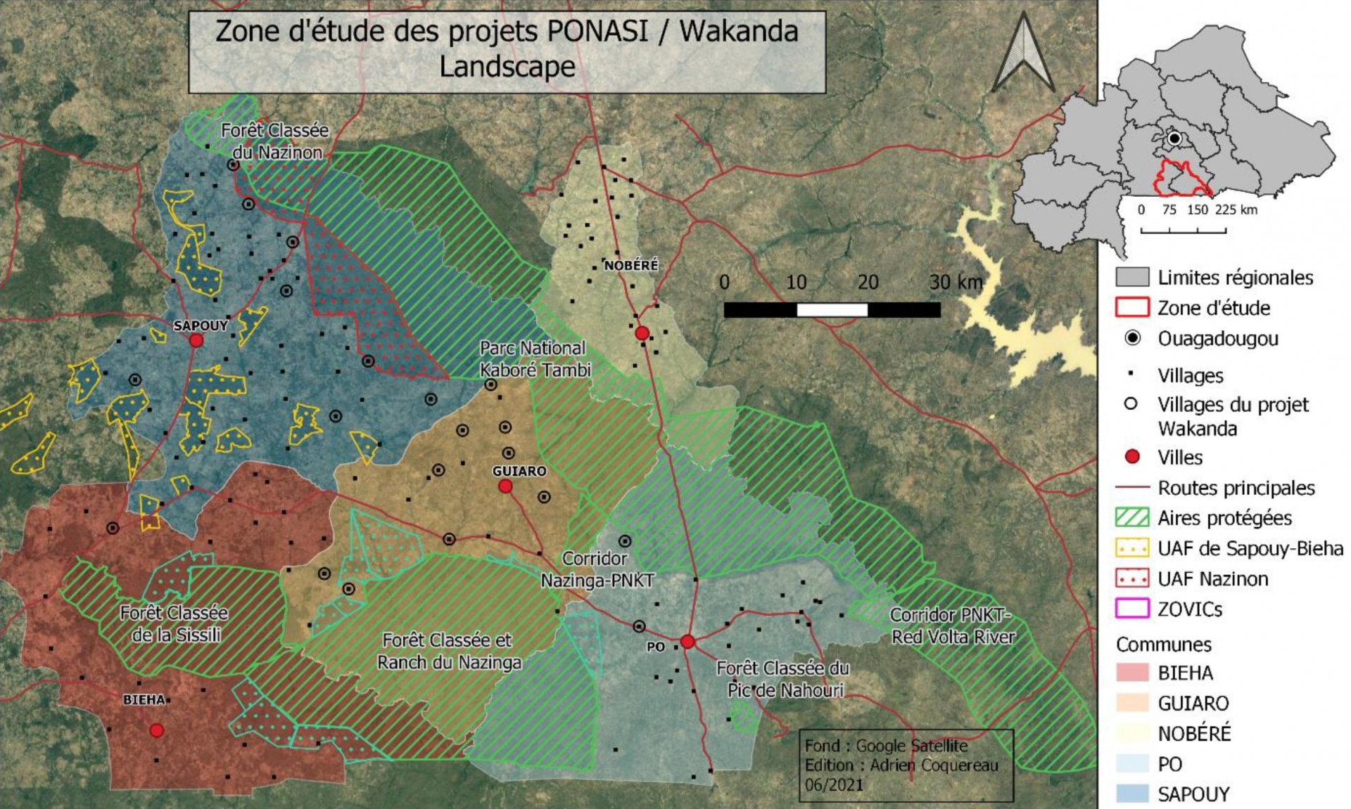
In Burkina Faso, the PONASI Protected Areas complex is one of the last large areas of preserved forest-savannah ecosystems in the country and constitutes an ecological continuum sheltering a great diversity of flora and fauna. Located in the south of Burkina Faso, it brings together: the Kaboré Tambi National Park (PNKT) and its two corridors, the classified forest and the game ranch of Nazinga, the classified forest of Sissili as well as the Village Zones of Hunting Interest (ZOVIC) bordering the village lands made up of 150 villages. This region is subject to many pressures on natural resources: forest degradation linked to the extraction of firewood and the production of charcoal, overgrazing in savannah areas, conflicts of use between the different land uses (crops , livestock, wildlife, etc.), poaching of wildlife in protected areas, uncontrolled bush fires. The landscape is also marked by a diversification of agricultural activities, the presence of large agroforestry areas among the cropping areas (shea, cashew, néré) which present a high added value for the development of the region, as well as the establishment of ecological corridors where methods of assisted natural regeneration of vegetation are practiced.
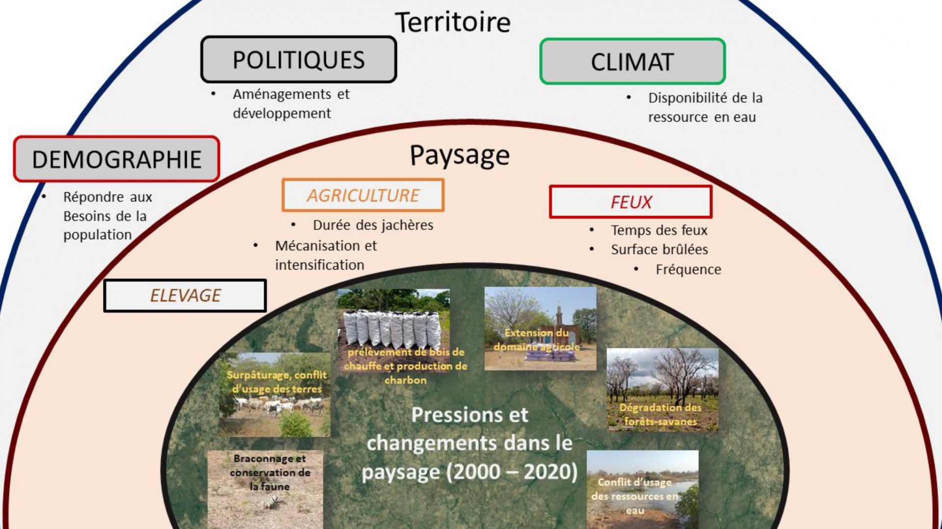
It is important to quantify and locate these different pressures in order to define support measures and target the relevant intervention areas.
Methodology
The proposed methodology is based on several key steps:
- Elaboration of a matrix of factors and hypotheses of changes in the landscape
- Mapping and analysis of land cover changes over the period 2000-2020
- Analysis of the change in biomass productivity over the period 2000-2020
- Identification of human factors of reduction or gain of plant biomass
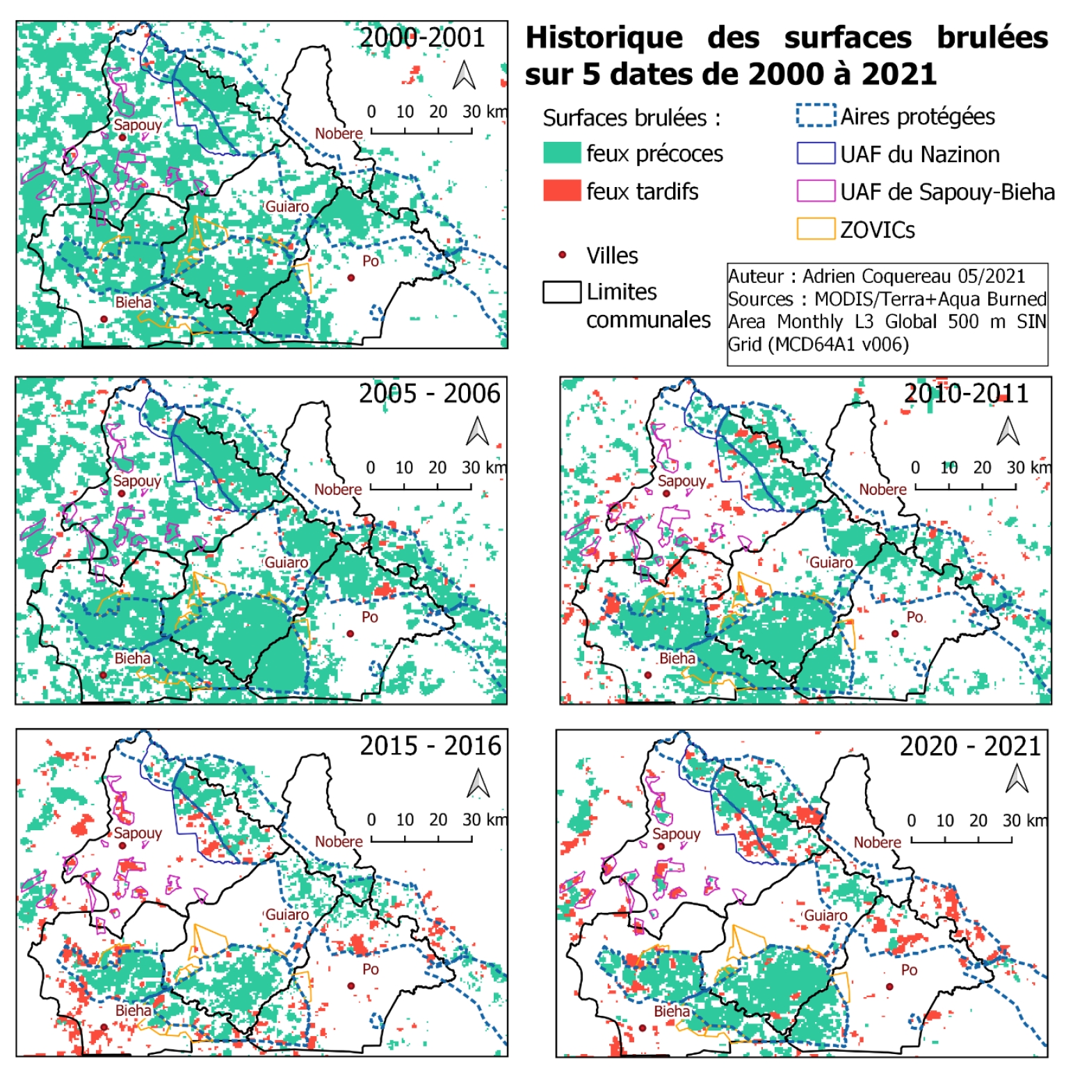
- Analysis of the evolution of fires in terms of burned surfaces, frequency and temporality (early and late)
Results
The protected areas of the PONASI complex are characterized by very contrasting changes in land use depending on the municipalities and protected areas. Some of them are gradually being occupied by cropping areas, in particular the classified forests of Nazinon and Sissili, but also UAFs and ZOVICs. The PNKT and the classified forest and the Nazinga ranch seem for the moment to resist this dynamic even if the crops are gradually approaching their borders. Finally, several pasture areas and entrances were observed. These dynamics testify to the saturation of agricultural land generated by a significant demographic evolution over the last twenty years.

Human factors map of declining biomass productivity
Human activities are slightly dominant in terms of factors increasing plant productivity in the study area. Human factors correspond to about 58% of the augmentation factors. This can be explained by natural or assisted regeneration of wooded savannah areas (21%), regeneration of grassland areas (grassy savannahs) and shrub savannahs (19%), potentially thanks to the limitation of grazing in protected areas, and the potential increase in agricultural yields and agroforestry densification (12%).
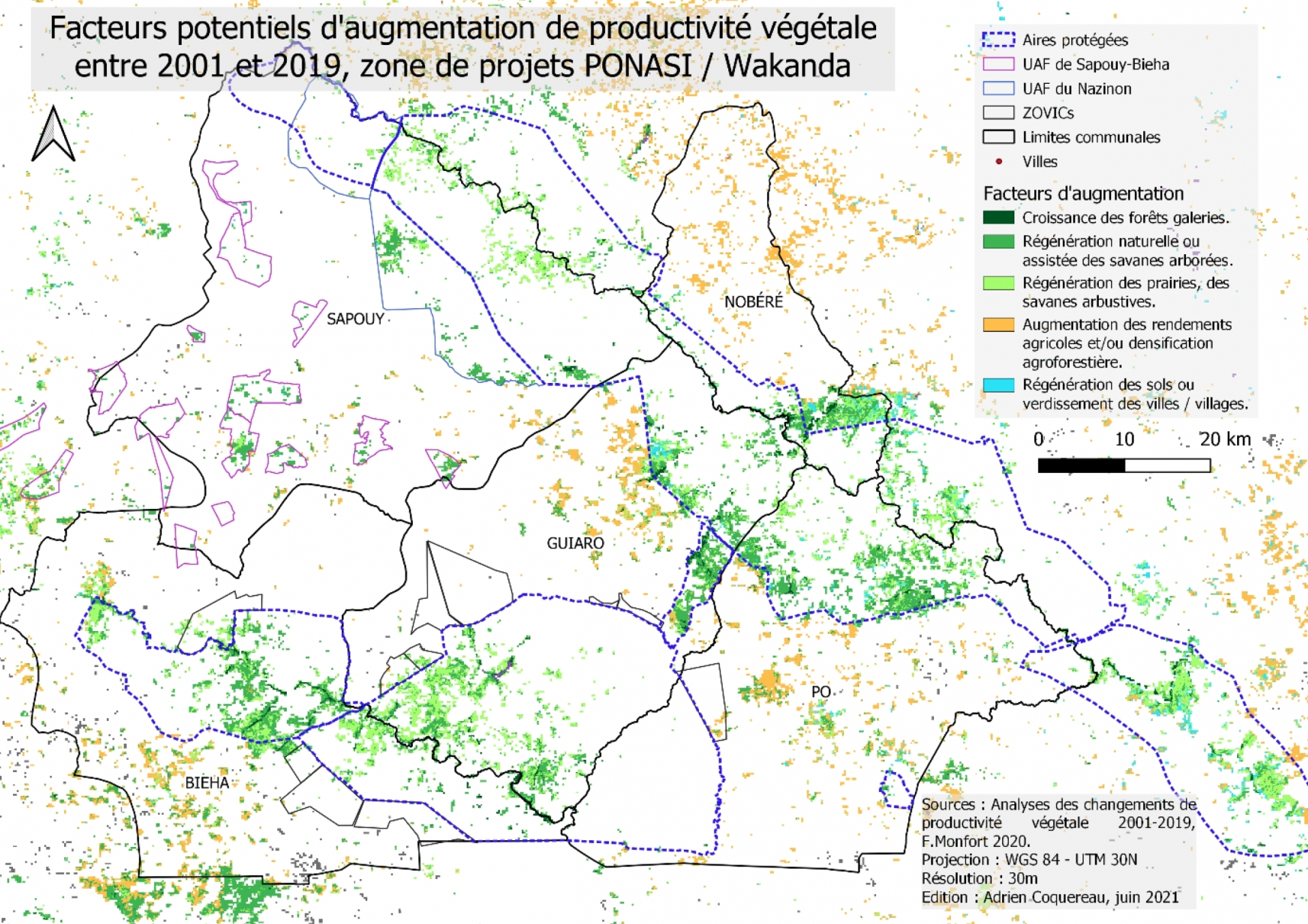
Human factors map of increasing biomass productivity
Throughout the study area containing the municipalities and protected areas, fires have tended to decrease since 2005. Between 2000 and 2005, the areas burned increased, which is perhaps partly due to the phenomena of expulsion which correspond to the period of establishment of Corridor 1 between the PNKT and Nazinga. Farmers seek new land and clear other land in the study area. However, most of the fires have been in protected areas since 2005. The degree of precocity of the fires varies little when we observe the entire study area. It can be seen that the trend in burned areas remains downward over the period from 2000 to 2020. However, the proportion of late fires is clearly higher and tends to increase over time.