Documents
Filters
Remote sensing
143
results
Technical document
Organic Agriculture, Agroforestry, Spatial Planning, Bioenergy, Climate, Forest, Market, REDD+, Remote sensing
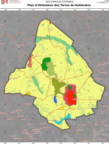
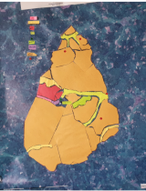
Koutoukro 1 - Local Development Plan (LDP), co-constructed as part of the PRM2 Project
Technical document
Organic Agriculture, Agroforestry, Spatial Planning, Bioenergy, Climate, Forest, Market, REDD+, Remote sensing
M'Bohoin - Local Development Plan (LDP), co-constructed as part of the PRM2 Project
Technical document
Organic Agriculture, Agroforestry, Spatial Planning, Bioenergy, Climate, Forest, Market, REDD+, Remote sensing
Yakassé-Comoé - Local Development Plan (LDP), co-constructed as part of the PRM2 Project
Technical document
Organic Agriculture, Agroforestry, Spatial Planning, Bioenergy, Climate, Forest, Market, REDD+, Remote sensing
Nyan - Local Development Plan (LDP), co-constructed as part of the PRM2 Project
Project report
Agriculture, Agroforestry, Bioenergy, Biodiversity, Market, Remote sensing
Progress report from June to December 2023 - ACAMOZ 2 (portuguese)
Communication
Organic Agriculture, Agroforestry, Spatial Planning, Bioenergy, Climate, Forest, Market, REDD+, Remote sensing
PRM2 Newsletter - Preserve the biodiversity of Mabi-Yaya & Strengthen the socio-economic development of the Mé
Communication
Organic Agriculture, Agroforestry, Spatial Planning, Bioenergy, Climate, Forest, Market, REDD+, Remote sensing
Presentation – Review of the PRM2 project activities at the 3rd Steering Committee meeting: a zero deforestation territory resilient to cli…
Technical document
Biodiversity, Degradation-Restoration, Forest, Remote sensing
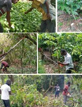
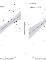
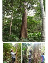
Internship report - Mapping of plant biodiversity in the Mabi-Yaya Nature Reserve in Côte d’Ivoire
Communication
Biodiversity, Degradation-Restoration, Forest, Remote sensing
Presentation - Mapping of plant biodiversity in the Mabi-Yaya Nature Reserve in Côte d’Ivoire
Technical document, Pedagogical
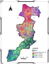
Spatial Planning, Remote sensing
Methodology for developing a participatory land use plan at the village level (french)
Technical document, Pedagogical
Spatial Planning, Remote sensing
Toolkit for developing and facilitating a participatory land use plan at the village level (french)
Technical document
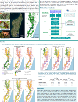
Agriculture, Spatial Planning, Forest, Remote sensing
Spatial and forest characterisation of the villages involved in the Forest4Future project (french)
Communication
Biodiversity, Degradation-Restoration, Forest, Modeling, Remote sensing
Poster - Predicting future suitable environment for South East Madagascar endemic species for an effective protected network
Annual reports
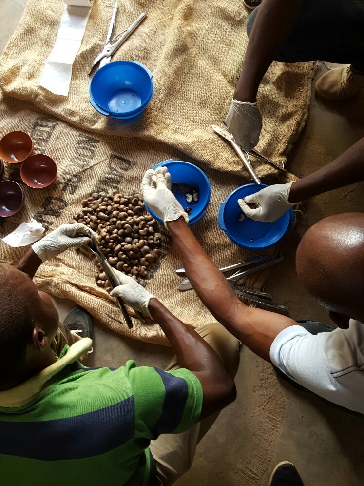
Agriculture, Organic Agriculture, Agroecology, Agroforestry, Agroprocessing, Spatial Planning, Bioenergy, Biodiversity, Climate, Degradation-Restoration, Forest, IWRM, Market, Modeling, REDD+, Remote sensing, ICT
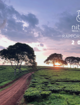
Annual Report 2022 Nitidæ
Technical document
Agriculture, Forest, REDD+, Remote sensing