Documents
Filters
Remote sensing
142
results
Technical document
Biodiversity, Climate, Degradation-Restoration, Forest, Remote sensing
IUCN Congress's Presentation - What future for biodiversity in Madagascar? Taking into account scientific projections in conservation and d…
Scientific publication
Agriculture, Agroforestry, Biodiversity, Climate, Degradation-Restoration, Forest, REDD+, Remote sensing
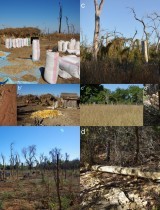
Changes in land occupation and use between 2016 and 2019 in the south-east of Côte d'Ivoire: impact of cash crops on the forest
Pedagogical
Agriculture, Degradation-Restoration, Forest, Remote sensing
Analysis of changes in plant productivity: objectives and methodology
Scientific publication
Climate, Degradation-Restoration, Forest, Remote sensing
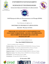
Presentation of the thesis defense - Measurement and monitoring of forest cover dynamics: case of the humid forest ecoregion of eastern Mad…
Communication
Agriculture, Organic Agriculture, Agroforestry, Spatial Planning, Bioenergy, Biodiversity, Climate, Forest, Market, REDD+, Remote sensing
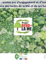
The Mé REDD + Project - four years of commitment and innovation in the service of the Mé forests and its inhabitants
Technical document
Agriculture, Biodiversity, Climate, Degradation-Restoration, Forest, Market, REDD+, Remote sensing
Exploratory diagnosis of agrarian dynamics of the Mount Ribaue and M'Paluwe region - Intermediary report
Technical document
Agriculture, Biodiversity, Climate, Degradation-Restoration, Forest, Market, REDD+, Remote sensing
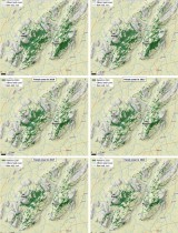
Historical and future deforestation analysis of Ribaue Mountains (Mount Ribaue and Mount M’paluwe)
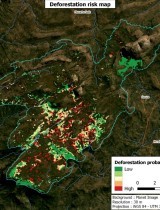
Technical document
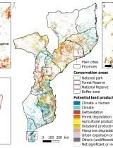
Agriculture, Agroecology, Spatial Planning, Biodiversity, Climate, Forest, REDD+, Remote sensing
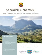
Landscape Dynamics Assessment of Mount Namuli Region
Communication
Agriculture, Agroecology, Spatial Planning, Biodiversity, Climate, Forest, REDD+, Remote sensing
Mount Namuli - Community conservation area in the Republic of Mozambique

Annual reports
Agriculture, Organic Agriculture, Agroprocessing, Spatial Planning, Bioenergy, Biodiversity, Climate, Degradation-Restoration, Forest, IWRM, Market, Modeling, REDD+, Remote sensing, ICT
Annual Report 2019 Nitidæ
Communication
Agriculture, Organic Agriculture, Spatial Planning, Biodiversity, Climate, Degradation-Restoration, Forest, Market, REDD+, Remote sensing
Presentation by Cédric Rabany during the Iddri/AFD Webinar "Towards sustainable cocoa: potentials and challenges of a complex value chain"
Scientific publication
Agriculture, Biodiversity, Climate, Forest, Market, Remote sensing
Article - It’s not just poverty: unregulated global market and bad governance explain unceasing deforestation in Western Madagascar
Project report
Agriculture, Spatial Planning, Forest, Market, Remote sensing
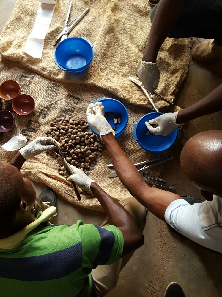
Activity report of the AFAFI-Nord-AF phase 1 cashew value chain development project June 2020
Scientific publication
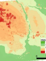
Agriculture, Spatial Planning, Climate, Degradation-Restoration, Forest, Modeling, Remote sensing
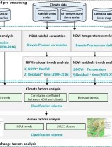
From land productivity trends to land degradation assessment in Mozambique: Effects of climate, human activities and stakeholder definitions
Communication
Spatial Planning, Climate, Degradation-Restoration, Forest, REDD+, Remote sensing, ICT